


Voting District 130001, Chautauqua County, New York
About
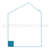
Outline

Summary
| Unique Area Identifier | 625904 |
| Name | Voting District 130001 |
| County | Chautauqua County |
| State | New York |
| Area (square miles) | 36.28 |
| Land Area (square miles) | 36.26 |
| Water Area (square miles) | 0.02 |
| % of Land Area | 99.94 |
| % of Water Area | 0.06 |
| Latitude of the Internal Point | 42.04171900 |
| Longtitude of the Internal Point | -79.71148920 |
Maps


Graphs
Select a template below for downloading or customizing gragh for Voting District 130001, Chautauqua County, New York


Neighbors
Neighoring Voting District (by Name) Neighboring Voting District on the Map
- Voting District 070001, Chautauqua County, NY
- Voting District 070002, Chautauqua County, NY
- Voting District 190001, Chautauqua County, NY
- Voting District 260001, Chautauqua County, NY
- AMITY TWP Voting District, Erie County, PA
- GREENFIELD TWP Voting District, Erie County, PA
- VENANGO TWP Voting District, Erie County, PA
- WAYNE TWP DIST EAST, Erie County, PA
- WAYNE TWP WD WEST, Erie County, PA
Top 10 Neighboring County Subdivision (by Population) Neighboring County Subdivision on the Map
- Venango township, Erie County, PA (2,297)
- Greenfield township, Erie County, PA (1,933)
- Clymer town, Chautauqua County, NY (1,698)
- Wayne township, Erie County, PA (1,659)
- Sherman town, Chautauqua County, NY (1,653)
- Mina town, Chautauqua County, NY (1,106)
- Amity township, Erie County, PA (1,073)
- French Creek town, Chautauqua County, NY (906)
Top 10 Neighboring Unified School District (by Population) Neighboring Unified School District on the Map
- Corry Area School District, PA (14,849)
- Wattsburg Area School District, PA (10,412)
- Clymer Central School District, NY (3,208)
- Sherman Central School District, NY (2,840)
Top 10 Neighboring State Legislative District Lower Chamber (by Population) Neighboring State Legislative District Lower Chamber on the Map
Top 10 Neighboring State Legislative District Upper Chamber (by Population) Neighboring State Legislative District Upper Chamber on the Map
Top 10 Neighboring 111th Congressional District (by Population) Neighboring 111th Congressional District on the Map
Top 10 Neighboring Census Tract (by Population) Neighboring Census Tract on the Map
- Census Tract 117.02, Erie County, PA (5,370)
- Census Tract 367, Chautauqua County, NY (4,257)
- Census Tract 366, Chautauqua County, NY (3,521)
- Census Tract 118.02, Erie County, PA (3,221)
- Census Tract 120.01, Erie County, PA (2,728)
- Census Tract 118.01, Erie County, PA (2,700)